Search

Contact      Press      Blog      About

Pocket Trail Backpacking Adventure

Been there recently?

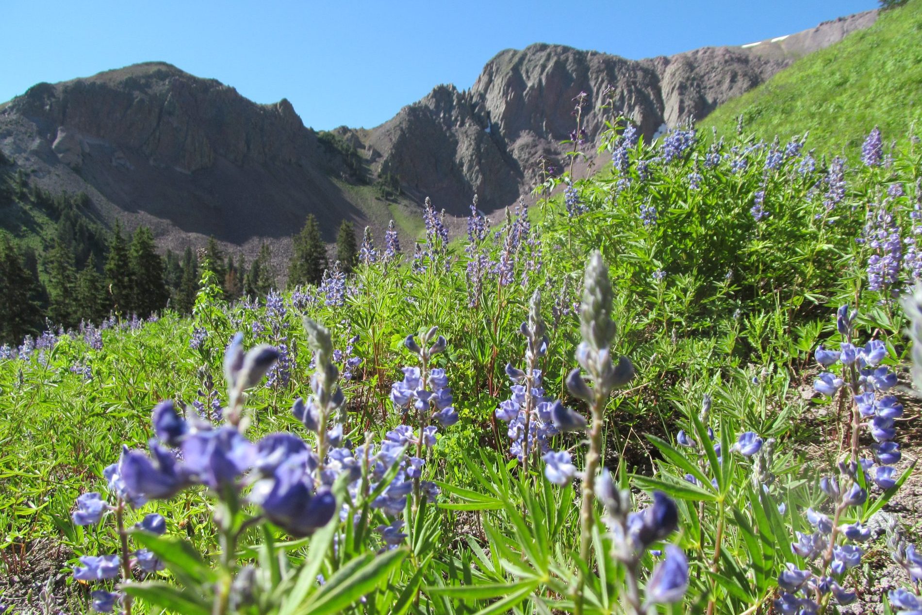
The pocket is a U-shaped valley just North of Delano Peak high up in the Tushars. While this is a popular trail, it is highly likely that you won’t see another hiker for your entire trip, but that doesn’t mean you will be alone, mountain goats roam these hills as well as other wildlife that will be just as hesitant about you as you are about them! The Trail will take you past crystal clear streams flowing from the glacial Moraine and up to vistas where, on a clear day, you can see multiple Rambling Ranges off in the distance.

There are a wide variety of trails that connect with the Pocket trail, which gives you lots of options on where you strap on your pack and strike out on your adventure. A popular starting point is past Mud Lake, you have to be in a 4×4 for access. Drive past Mud Lake, go over the top of the ridge, and on the right will be the Bullion Canyon Trailhead with a bathroom. Striking out from here you will be on the Bullion Canyon trail.

The Pocket Trail, trail number 216, is well marked and traverses across ridges from peak to peak before dropping you into the Pocket.

.

1 Day
Hiking
Summer
  • Departure

    Beaver, UT
  • Dress Code

    Cool and casual, active wear
  • Features

    Single-Day
  • Not Included

    Family Friendly
    Food Recs
    Multi-Day
1

First: Getting There

Getting up to the starting point from the city of Beaver is a good one and a half to two-hour drive. Leaving Beaver, you will travel up Highway 153 to mile marker 16 where you can take a left onto FR 123 toward Big John’s Flat. You can start trekking here or if you have a 4-wheel high clearance vehicle, drive onto the trail to the parking lot at Bullion Pasture Trail. If you were still traveling on 4 wheels, it is time to hop out and put on your pack, it is on foot from here out.
2

Then: Trail 216

From Bullion Pasture Trailhead, you will need to hike 1.5 miles down into Bullion Canyon to the well-signed junction with trail 216, the Pocket Trail. From there it is switchbacks and stream crossings and scrambles as you make your way into the Pocket. There are numerous bloggers that have documented their routes and trip highlights, the best of which is Into The Tushars, check out his post for more details on the hike.
3

Optional: Camping

There are no formal campgrounds along the trail, as with many backpacking adventure routes, you will see spots used by other travellers and dispersed camping is pretty much your only option. Remember to camp responsibly, pack it in and pack it out. There is a useful, free brochure/map of Upper Bullion Canyon trail system available at the USFS office and usually at the trailheads.

Tour Location


Ramblers